Applications
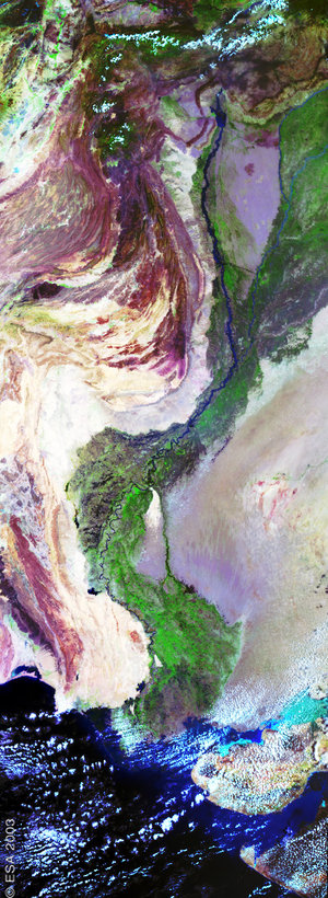
East Africa and Middle East - AATSR - 11 April 2002
This AATSR image features a long strip of 500 km swath extending from Euphrates valley in the Middle East to Lake Tanganyika in Central Africa, with the Red Sea separating Saudi Arabia from Sudan. To the south, Lake Victoria is visible, bordered by the Uganda, Kenya and Tanzania. The highly vegetated lands (shown in red) in this tropical area contrast with the arid lands around the Red Sea.
Technical Information:
Instrument: Advanced Along Track Scanning Radiometer (AATSR)
Date of Acquisition: 11 April 2002
Orbit number: 00590
Instrument features: AATSR is a visible and infrared sensor with nadir-viewing and forward-viewing angles. This should enable it to measure sea surface temperatures with an accuracy of 0.3 Kelvin.